As hoped, I woke up this Monday morning in Baudette and set out for a place I’ve been talking about riding back to for several years: Angle Inlet Minnesota, that little spike jutting up at the top of our state. As I rode West on Hwy 11 from Baudette, I had the bright sun rising at my back, and a light, comfortable breeze filling the air with the sweet fragrance of freshly cut hay fields and what I can only describe as the incredible smell of fields of clover. The ride to Warroad was spectacular, and I topped off my fuel tank there because I knew there was over 60 miles between Warroad and Angle Inlet, and more than 20 miles of that road was bad dirt. Here are some photos of my adventure today.

“Waters of the Dancing Sky Scenic Byway”. What a great name for a Scenic Byway!

While approaching Williams MN on Hwy 11, I saw this building off in the distance, so I detoured into town to get a closer view.
This is the front of that building. I didn’t wander onto the property, and I couldn’t find anything or anyone to tell me what it was. Maybe I’ve seen too many abandoned schools lately, but I’m guessing it was a school?
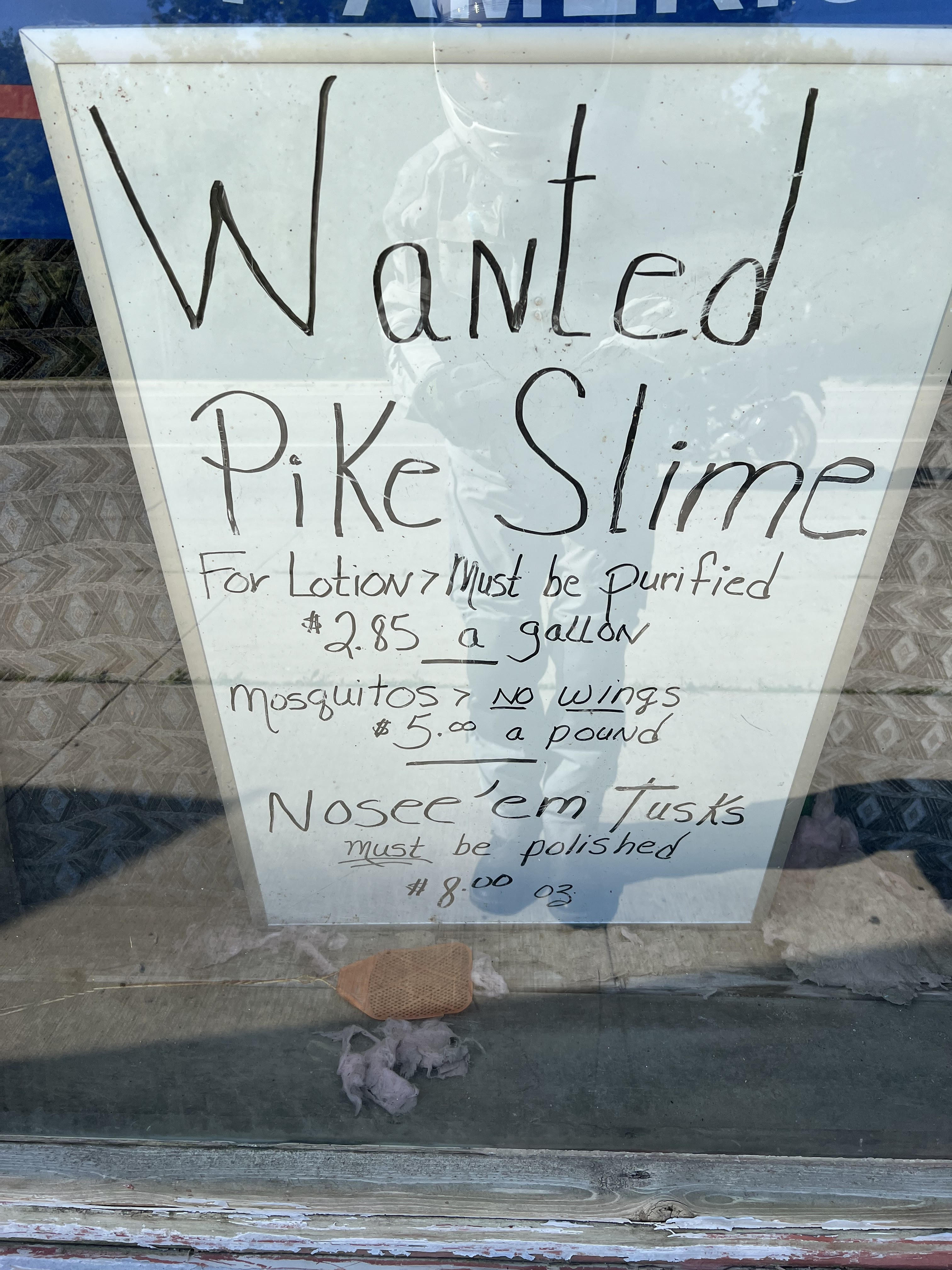
The border crossing into Canada went very well, and about 30 miles later I turned onto this paved road to find this warning sign. I thought, great, I’ve had to battle mosquitoes and biting flies each day, and now I have to look out for flying stones. On the bright side, I’d bet it’s easier to get a pound of de-winged stones than it is to get a pound of de-winged mosquitoes. 😉.
I’m still in Canada at this point where the pavement ends and the dirt begins. In around 1990, I made this trip on a large touring bike, pulling a small trailer no less. Then, the road surface was very loose and very difficult to ride on. This time, the surface was more hard-packed, though there were still many stretches of very loose gravel and rough washboard. More on the washboard later.
In order to get to Angle Inlet by road, you must enter Canada first, and then re-enter Minnesota/the U.S. before reaching Angle Inlet proper. This means a total of 4 border crossings in all.
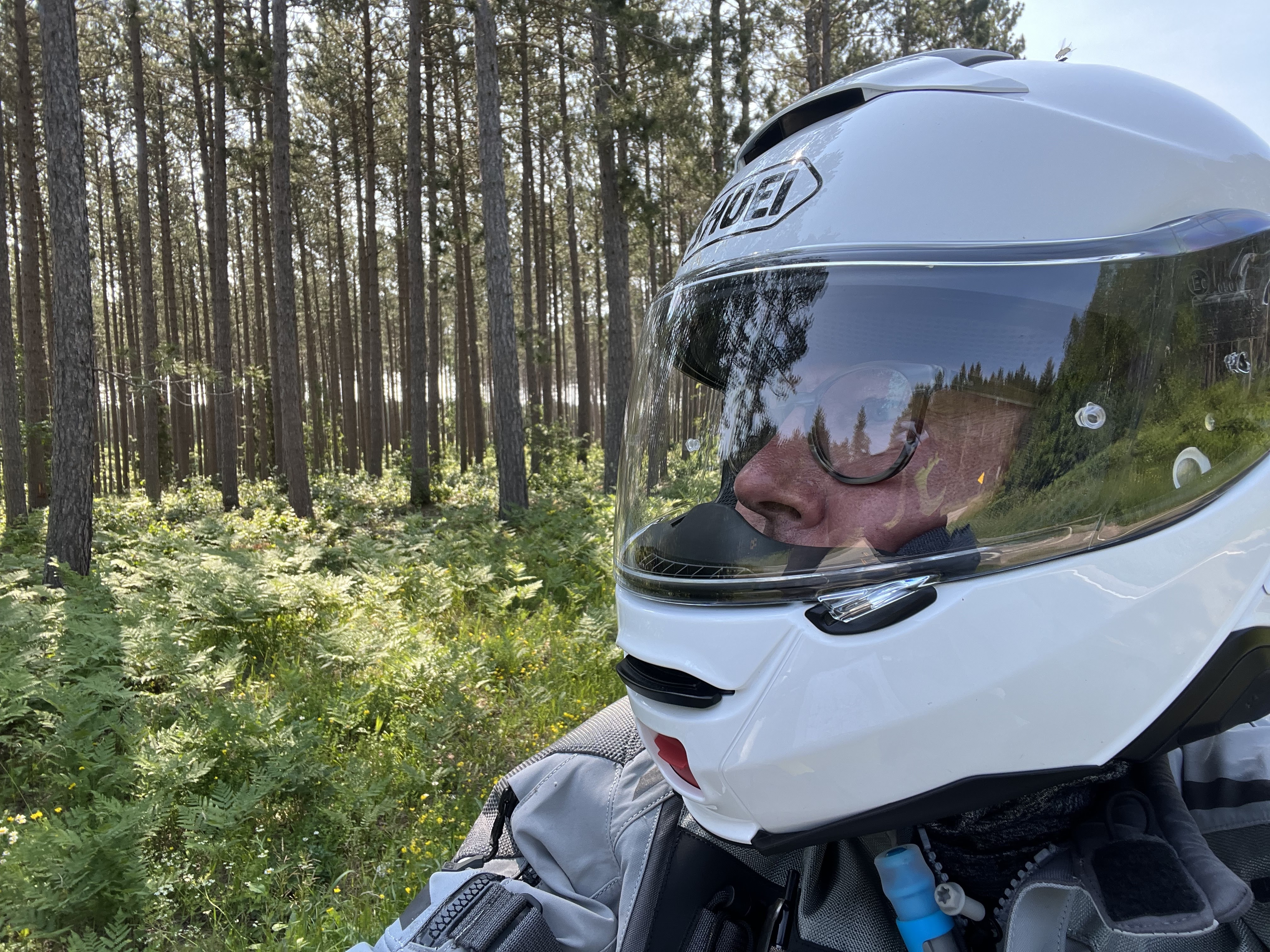
Each time I stopped along this road, the flies descended like a plague of… flies. I was glad to be wearing full riding gear and a full-faced helmet along with a neck gaiter to cover any skin. Fortunately, I didn’t have any trespassers into my helmet this time.
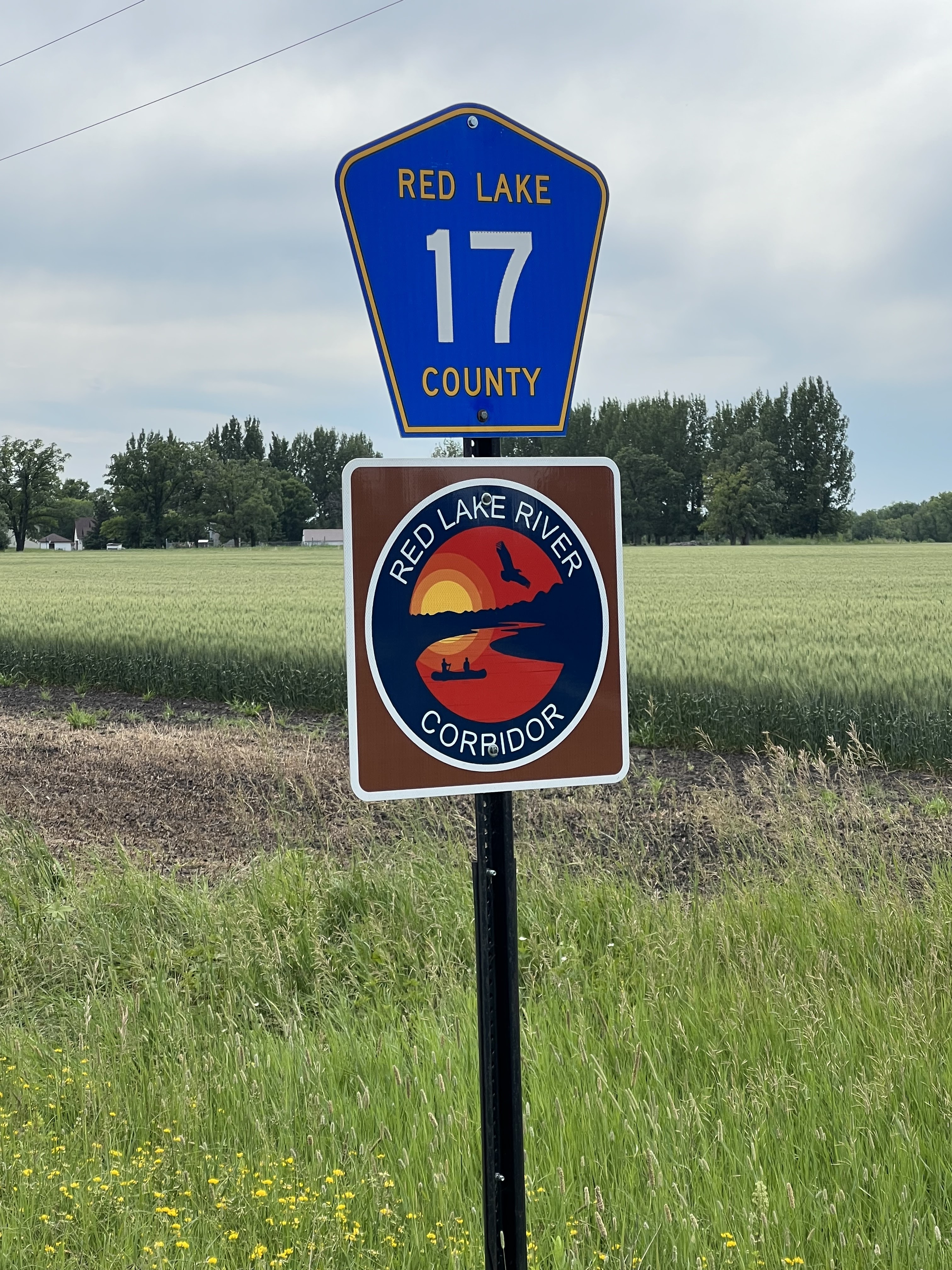
Much of the Northwest Angle is part of the Red Lake Nation.
I mentioned that to make the trip to Angle Inlet, you have to make a series a border crossings. There aren’t any manned border checkpoints, but when you first arrive here, at “Jim’s Corner”, you need to go inside and report your arrival to the United States from Canada using an iPad located inside this booth. Fortunately, the booth is both air-conditioned and relatively free of flies. I’d bet there were less than 100 flies inside the booth, which was a tiny fraction of the flies outside the booth. When it came time to leave Angle Inlet and return to Canada, I had been instructed to use the phone mounted outside the booth which connects directly to Canadian Customs. There’s a sign inside that says the iPad is not working for Canadian Customs for some reason.

Apparently, you can do a video chat on the iPad, but for some reason, maybe because I didn’t have an account set up, I had to fill out all my pertinent info about me, my driver’s license, and the motorcycle I was on, on an online form. It went quick and easy, and less than a minute later I got an approval message saying I could enter the U.S. I’m not sure what I would do if I couldn’t.

But I was approved, so I could smile when I reached my goal destination: the monument marking the Northernmost Point in the contiguous United States. Truth be told, this point isn’t actually the true northernmost point. The actual point is located in a swampy area just north of here, but there’s no way to access that point by vehicle. So the folks who run businesses in Angle Inlet decided in 2019 to have a monument made, and to place that monument where people/customers could stand in front of it with cheesy smiles and shiny, slightly misshapen heads (from wearing a helmet), who would then perhaps buy something from them before leaving. And that’s just what I did. I had a very nice lunch at Jerry’s Bar and Restaurant, and I bought several stickers at Young’s Bay Resort for my sticker boards at home proving I was here. Well played Angle Inlet! And I might add, it was worth it for me.
You might not be able to tell, but my bike’s smiling too.
So now that I’ve reached my goal here in Angle Inlet, and I’ve had a very nice lunch and purchased my stickers, it’s time to let Canadian Customs know that I’m coming back into their country. This booth is located next to Jerry’s Bar and Restaurant, and the iPad doesn’t work here for Canadian Customs either, so I had to use the phone mounted on the outside of the booth. There are no buttons on that phone; just pick it up and wait for someone to answer. Luckily, someone did answer, and the process was pretty quick and easy. In no time I was off into the dust of the dirt road.
Welcome to Manitoba!
With Angle Inlet well behind me, I celebrate my return to pavement under a chorus of flies.
Actually, part of the reason I stopped here was that the washboard-rough road had given my bike such a pounding that the left mirror bolt came loose so that the mirror was swinging in the breeze. I thought I might attempt to tighten it here, but the flies were such a distraction that I decided to make the repairs when I reached Warroad.
Here I am in Warroad making said mirror repairs. My tool kit is located under the seat, which meant I had to remove my dry bag and then the seat to get to the tools. A 5 minute process to make a 2 minute fix. It’s not an adventure if there isn’t the occasional hiccup.
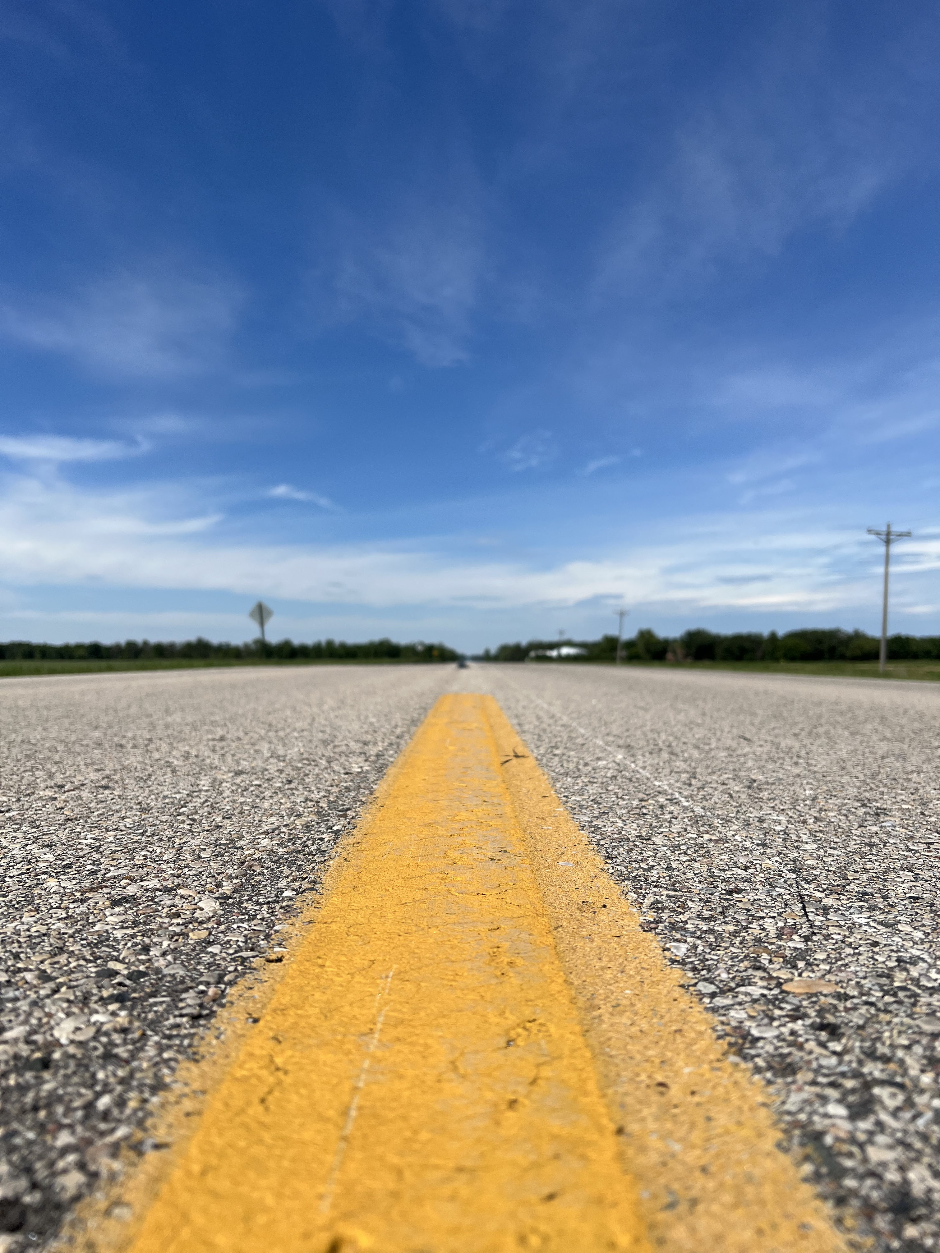
My route from Warroad to my next destination in Huot MN took me on a journey past fragrant fields, and towns that I didn’t know existed, like Salol and Strathcona. At one point I just stopped on the road and turned off the bike. It was quiet. No cars, and no sounds except for the breeze rustling the nearby field of grasses. It smelled of clover, and it was wonderful. If I would have had a lawn chair with me, I’d probably still be sitting there.

This is the road leading to the park where my next destination, the Old Crossing Treaty Memorial, was located. Ironically, while I was preparing to mount my bike in front of the customs booth next to Jerry’s Bar and Restaurant in Angle Inlet, a man came over to me and struck up a conversation. His leg was bleeding from a horse fly bite, and he put his foot on my foot peg and scratched at other bites on his leg. He said he was from Huot, where the Old Crossing Treaty Memorial is located. He warned me that I would have to ride a stretch of dirt road in order to reach the memorial. Then it dawned on him that I had already ridden nearly 30 miles of miserable dirt road to reach Angle Inlet. He said, “Yeah, I suppose I didn’t really need to warn you about riding just a mile on another dirt road”. We both nodded knowingly, and he limped away with blood dripping down his calf. I chuckled. Good talk.
We do have some neat signs out there.

Here is the Old Crossing Treaty Memorial that was placed here by the United States in 1932. According to signage here and nearby, a treaty was signed within the area of this park between the United States and the Pembina and Red Lake Bands of Chippewa Indians that resulted in the Chippewa ceding 3 million acres of land in northwestern Minnesota and northeastern Dakota to the United States thus allowing the settlement of the Red River Valley. Nothing I’ve read states what the Chippewa got out of the deal, so I’m not sure how I feel about this monument. It makes me think back to last month, while collecting another Grand Tour of MN site, the largest peace pipe in the world, located in Pipestone MN, where I chatted with an older-than-me gentleman who ran the gift shop at the peace pipe monument and was a Chippewa Indian. He shared with me what it was like growing up Native American, and he said that, as a child, he always wondered why nobody wanted to be the Indian when they played “cowboys and Indians”. He shared a few other stories with me that I won’t go into here but, after visiting the Old Crossing Treaty Memorial today, I would love to sit down with him again and get his perspective on it.

As I ride my motorcycle down the road, I’m punching a hole in the air with my bike and with my body. If there are leaves on the roadway, my wake blows them to one side or the other. That is, my presence is being felt physically by my movement through that particular space. The same can be said, I think, for our presence in other people’s lives, though not physically in the same sense that leaves are blown from the road. To those of you who receive my blogs by email, thank you for the many kind comments you have made, and thank you for your presence, both past and present, in my life.
As always, thanks for looking!